Friday, June 11, 2010

Day 11- Oakland, CA to Del Norte Coast Redwood State Park, CA

The first thing we did when we left the hotel was to drive over the Bay Bridge, which we found out has a $4.00 toll. We held off on leaving until about 9:30 so that we could miss some of the morning traffic.

The Golden Gate Bridge was very cool. The traffic on this bridge was significantly less. The bridge was a little redder than I had anticipated, and it seemed a lot longer than I had thought it would be.

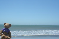
After we got out of the Bay Area, we took a detour to the beach near Bodega Bay at Doran Park State Beach. It was really cool to walk along the sand next to the Pacific Ocean. It was actually really chilly when we got out of the car, but it was significantly warmer once we got onto the sand near the water. We picked up a few shells and enjoyed the views before heading on.

Finally, we started to see some Redwoods on the side of the road as we were driving along. These were the Coastal Redwood species and they were much more slender, but much taller on average than the Sequoias that we had seen.

Thursday, June 10, 2010

Day 10 - Sequoia National Park, CA to Oakland, CA

The Auto Log was a fallen tree that folks used to be able to park their cars on and take pictures. You can’t actually park your car there anymore, but we did get to walk up on top of it and take some pictures. The base of the tree was gigantic!
After we stopped at the Auto Log, we were stopped taking pictures of some nearby trees when I looked up and saw our first live bear on the trip. He was actually quite small and was fairly skittish. He went up to the nearby trashcan and started snooping around trying to find something to eat. We had to get a picture with Tucker.

The General Sherman Tree is the largest tree in the park as far as volume and total mass. It is 275 feet tall and over 2200 years old. We took a half a mile hike down to the tree and it was so massive! It was hard to imagine a tree could be that big.

When we left Sequoia National Park, we went downhill for a long time and Katy didn’t have to hit the gas for about 10 or 12 miles. This resulted in us getting the best gas mileage we have ever seen on the car. We got all the way up to 48.3 mpg before she had to hit the gas.

We made it to Oakland at about 5 pm and the driving in the Bay Area was a little hectic. We were on about 5 different interstate sections before we made it to the hotel, and we hadn’t even been into San Francisco yet.

Day 9 - Lake Mead, NV to Sequoia National Park, CA


Welcome to California 4822 – After a little while, we began to see “real desert” and we got to the California state line. Although it was pretty barren looking, there were some trees and the cacti were getting more numerous. It was a little weird to see huge sand dunes all around us.
When we got to Tehachapi Pass, we saw a huge windmill farm. There were hundreds of windmills from those that were about 15-20 feet tall to the biggest windmills we had ever seen. Apparently this is one of the largest farms in the US.
We passed by miles and miles of fruit farms on our way through California. There were oranges, cherries, apples, avocados, grapes, lemons, pomelos, and grapefruits. We stopped near Porterville, CA and bought some cherries, oranges, and honey that turned out to be pretty amazing.


Our campground at Sequoia National Park was very beautiful. There were only 18 sites at the Mill Creek area and we were very near the river. There was plenty of tree cover and lots of wildlife.


Tuesday, June 8, 2010

Day 8- St. George, UT to Lake Mead, NV (The Hoover Dam)

This part of Arizona was beautiful. We were in the Virgin River Gorge. Many of the roads we drove on had to be carved straight out of granite or marble and it must have taken a long time and a lot of money.
Nice bikers from England took our picture at the Nevada State Line. We were nice enough to return the favor for them.

The next few pictures are of us driving down Las Vegas Blvd. Also known as the Strip.

Tucker overlooks the Hoover Dam and Lake Mead.
Here is a look at the exhibit hall where many of the informational activities were located. Also, it had AC, which was a blessing on this day when it was 110 on the concrete.
A replica in the museum of how the Dam was built.

the Colorado River as it comes out of the dam.
Behind us is the new Hoover Dam Bypass which will be open later this year. It was almost as awesome as the Hoover dam :)
We camped near Boulder City at Las Vegas Bay.
Hemenway Park has a herd of big horned sheep that frequent it on hot afternoons. I had been looking forward to seeing a big horned sheep for the whole trip. This group did not disappoint.

Dean loves this picture. There were close to 50 sheep in the park and they were just hanging out eating the fresh cut grass. Other wildlife spotted at our campsite were rabbits, a coyote, and lots of birds.

Day 7- Moab, UT to St. George, UT
After packing up our camp, we took off for our drive across southern Utah. Along the way we passed through Capitol Reef, a portion of Utah where pieces of land have broken and slid up sideways to expose different layers of rock.
Some of the landscapes we passed after Green River
The Middle of Nowhere! Petrified Sand Dunes are all you can see beyond the ghostly white sandstone canyons.
As we were driving along, there were multiple viewing areas where we could stop and look out over various canyons, desert areas, and rock formations.
Katy was amazed at the multitude of different rock colors throughout our drive. We saw many formations that were white colored like this one, red, yellow, black, and blue.
This is "Big Rock Candy Mountain," and we just had to get a picture of it.
Near Circleville, UT
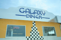
We had lunch at an out of the way diner in Hatch, UT called the Galaxy Diner and the food here was fantastic. Katy had the lunch special of pasta and garlic break and I had the fish and chips plate. As we left, we got a strawberry milkshake to go. All the food was great and the diner had a great charm.
we didn't see any wildlife :(
We took the scenic route through southern Utah in the hopes of driving through Zion National Park, but although we got a picture at the sign, roadwork in the park forced us to go around through northern Arizona and added about 2 hours onto our trip.

Day 6- Canyonlands National Park, Moab, UT

On Day 6, we headed from our campsite, this time to Canyonlands National Park, about 25 miles away from Arches National Park. Canyonlands had miles and miles of river carved canyons with some awesome views.
We visited the "Island in the Sky" part of Canyonlands where many of the views of the canyons from high above were located. It was quite a climbing drive up to the top.
the Breathtaking scenery. We were so far up in the air. We saw lots of lizards and there were tons of gnats. The gnats made it almost impossible to stand still outside.
Here is Katy using her mad photographer skills to get us both in the picture with the overlook behind us.

We really enjoyed the views from the top of the "Island in the Sky." At the visitor center we read that on a clear day you could see up to 100 miles across the park and on the other side of it.
Dean in front of the Mesa Arch. It is perched over an 800 ft cliff. see the next picture.
The hike this arch showed the wide variety of plant life and rock formations that are found in the Island in the Sky section of the park.
This picture and the previous two were taken at the Mesa Arch. It was a short hike out to see the arch, and it was beautiful, even though the park isn't known for it's arches.
This is one of my favorite signs of the entire trip! Who would have thought? Cows crossing the road!
On our last night at the Goose Island campsite, we went out and got some pictures with the sign and with Tucker. We were very impressed with the site and how well it was maintained.
This is a view of our campsite from the bike trail that ran in front of it. That's our little orange and grey tent. Our home sweet home :)